
Your cart is currently empty!
Month: June 2018
-
Hot!
Temps into the higher 90s today with a ‘feels like’ over 100 – good thing the water is 73. Looking at a 50% chance of storms coming through tonight; they are mostly expected to stay in a line west of us but a few could break free and make their way here. Probably worth tying…
-
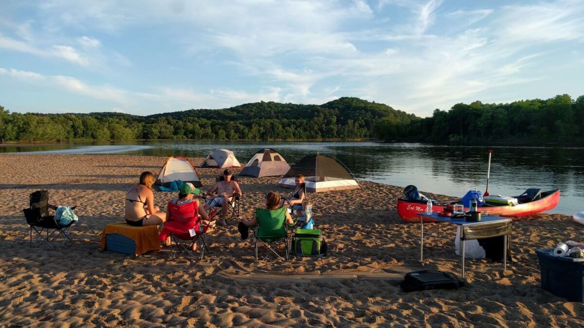
Slow and steady
Water levels are continuing to drop nicely upstream and it’s looking like we’ll have a decent number of sandbars above water by Friday with more coming out as the weekend progresses. It’s pretty likely you’ll be sharing some of the larger sandbars with new friends but at least they’ll be out there. Temperatures are expected…
-
Currently on track to re-open Thursday 6/28
Update: 6/25 Everything below still holds, sandbars should be back ~Thursday. We’re going to get a little more rain in our immediate area but further north is expected to get significantly less which is overall good news. We should know definitively by tomorrow (Tuesday) mid-morning. ======= We’re about a day away from peak river on…
-
17 Billion Gallons
It’s official, we’re out of commission well into next week. We’re expecting over 40kcfs of water on our stretch of river by the middle of this weekend. Just a couple days ago we were at 5kcfs and our cutoff is 15kcfs so you can understand why seeing 40kcfs in the NOAA predictions makes cancelling all…
-
Well…shoot. A lot can change in 48 hours.
The overall volume of water in the river system is tripling (or more) right now. New readings coming out of Castle Rock upstream already put us underwater and it’ll only get worse as the next few tributaries up the numbers before this water gets to us. Trips through Thursday are officially cancelled due to high…
-
Spike in river levels arriving Sunday afternoon
A very narrow storm rolled through last night and while overall rainfall totals weren’t a lot, it sat right on top of the entire river valley. Unfortunately, this has resulted in a pretty large spike in water levels throughout the whole system upstream of us. We’ll see the amount of water more than double between…
-
Looking ahead this week
This spring has been what I like to call reversion to the mean. Water levels continue to remain at or below the 100 year average which means a lot more sandbars than you’d usually see in June, certainly compared to the last few years. This coming weekend in particular looks to be relatively clear and…
-
Update on the weather this weekend
We’ve got a pretty unstable forecast in the sense that the National Weather Service doesn’t have a lot of confidence in it. The current climate models have come up with different conclusions about what’s going to happen when and with a stationary front, small changes could have a big impact. Yesterday the entire weekend was…
-
More Spring than Summer
Sandbars are out in force this weekend as we continue to enjoy water levels not seen in years. The weather looks very spring-y though with a chance for isolated storms overnight Friday and Saturday. On the bright side, partly sunny and highs in the upper 70s during the day, and forecasted rain amounts under 1/10th…
-
Small storm rolling through Saturday evening
I’ve gotten a couple questions about the weather coming through Saturday night – long story short, it’s not a factor. Longer story, there’s a long line of precipitation moving relatively quickly across the midwest that’ll move over our area from ~7pm-11pm tonight peaking around 9pm. Storm Prediction Center says less than 5% chance anything will…