Your cart is currently empty!
Wisconsin River Maps


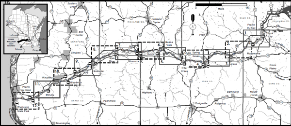
The river trail maps below were created and provided by the Wisconsin Department of Natural Resources.
For those of you renting through us, you will be provided with a waterproof topographic map covering your route and containing more specific information regarding your trip.
River Maps:
- Prairie Du Sac to Mazomanie
- Mazomanie to Arena
- Arena to Spring Green
- Spring Green to Lone Rock (Otter Creek)
- Lone Rock (Otter Creek) to Avoca (Buena Vista)
- Avoca (Buena Vista) to Muscoda
- Muscoda to Blue River
- Blue River to Boscobel
- Boscobel to Woodman
- Woodman to Wauzeka
- Wauzeka to Bridgeport
- Bridgeport to Wyalusing
