With all of the storms moving through this past weekend we’ve picked up a substantial amount of rain statewide. This rain is now making it’s way into our watershed and will drive water levels up above sandbars sometime Tuesday into Wednesday. I’d expect this to resolve in a 4-5 days though that’s dependent on where today’s rain falls as we still have a couple more active fronts moving through.
Luckily those currently appear to be staying south which means I’m still optimistic about sending trips out this weekend. It’s still early in the river prediction cycle so I expect we’ll see a lot of flux over the next day or two. It’s currently very high but I wouldn’t be surprised if that high water period isn’t shortened up a day or more.
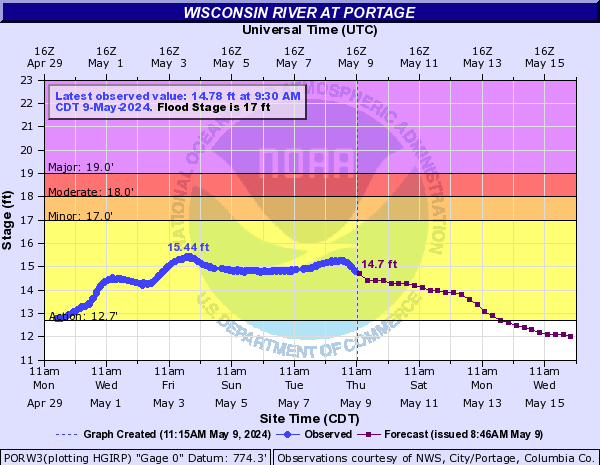
At current water release numbers up north, overnight trips are off the table from Tuesday until at least Thursday. Day trips may be doable but there will be very few places to stop while on the water.
We like to see 13.5′ or less on the graph below. Forecast updates typically happen everyday at ~8am and 8pm +/- a couple hours.