Can…can I say the word? Summer?

Wisconsin River Weather Forecast early August 2019

I haven't seen a forecast this good in a long, long time. Aside from great weather to be outside in, this dry sunny stretch should really help drive down those recent high water levels to their late summer lows. I'd expect sandbars to be out in force by roughly Wednesday (though we've already got a fair number out there) and if this keeps up, they'll be classically large (like football field or bigger large) by the coming weekend (Aug 3/4).

If those light easterly winds stay in the forecast, we're on track for a 10 out of 10 weekend and we definitely haven't had one of those yet this year. This coming weeklong stretch is by far the best overall conditions we've had all year.

Looking mighty fine

River levels are dropping quickly and as expected. We will just barely be able to squeeze trips out tomorrow (Friday) with Saturday and Sunday looking pretty good considering all of the rain that just made it's way through the system. If the mostly dry forecast ahead holds, we should be near normal flow rates and lots of sandbars very quickly, certainly by next weekend.

For this weekend, you can check out our previous updates for the nitty gritty but as I write this, the WI Dells are passing down through 11kcfs and the dam at the start of our stretch, Prairie Du Sac, is dropping quickly through 18kcfs (was at 27kcfs six hours ago). By late tonight we should be below our threshold of 15kcfs and I'm expecting to level off around 12-13kcfs Saturday morning through Sunday (1.5kcfs or so higher than the Dells due to the Baraboo River contributions between here and there).

Below is a recent satellite image from earlier this week at 12kcfs as the river was on the way up. I've added arrows to decent camping options. If an arrow has red, it's one of the safest bets as far as it will always be above water if we're putting trips out. It wouldn't hurt to download the full size image and bring it with you or mark these points on your own river map.

Sandbar availability on the Lower Wisconsin River at 13kcfs flow rate conditions

Bitchin’

Update: 7/24 12:12pm

Nailed it. Dam at Castle Rock just dropped to 10.5kcfs (my graph doesn't reflect this at time of post but my data straight from the source below does) which should get us to ~13kcfs here with room for error under our 15kcfs cap. I'm expecting this flow rate to mostly hold through the weekend or drop marginally given tributary flowrates.

This 12-13kcfs flow rate is close to what I was out in last weekend when we were sold out and didn't see much crowding on sandbars so while sandbars won't be the size of football fields, there should be space for everyone. Trips will begin going out as scheduled Friday morning.

Update: 7/24 10:07am

Coming down to the wire for Friday trips. There's good news 48 hours upstream, now just waiting to see it happen at 36 hours (Castle Rock) before making an official call one way or the other. My only hesitation here is that the Yellow River (the only major tributary between Petenwell, 48 hours upstream, and Castle Rock, 36 hours upstream) is running at 96% of it's median flow rate, i.e. high. USGS Gauge says it's adding an additional 4kcfs which, if accurate, is crazy for a river that normally contributes .15kcfs.

As for the rest of the weekend, I'm really starting to think we'll have sandbars by Saturday (albeit fewer and smaller than normal). As soon as this graph for Castle Rock gets at or below ~10kcfs we'll be in good shape a day and a half later. For Friday trips to go out, I want to see it happen before 3pm today. 3pm tomorrow for Saturday trips.

Update: 7/23 7:21am

Still feeling pretty positive about this weekend. Real test will be by tomorrow (Wednesday afternoon) when actual water levels that we'll see start getting released up north. But for now, the numbers coming out of the central part of the state are promising. Everything above 48 hours upstream looks great. There's currently a 20 kcfs discrepancy at that point (Lake Petenwell/Castle Rock) where 2-3kcfs is normal and the reservoir levels at Petenwell are plunging and nearly back to normal. Combined with the dry forecast, this leads me to believe we'll see some major cuts in flow rate up there very soon lest they draw down too far. I'm guessing that'll probably happen later today/overnight. Regardless, if that cut happens before noon on Wednesday we'll be good to go for Friday and beyond. Any changes will be reflected in the graph below usually twice a day (morning and late evening).

=================================

We squeaked through the weekend with only 30 minutes of rain and decent, if still somewhat elevated, water levels. That's now over as all of the storms across the state on Thursday, Friday, and Saturday have made their way into the river system. Our stretch will be underwater by this evening and peaking sometime Tuesday or Wednesday in the mid to upper 20kcfs region (we aim to be under 15kcfs, normal is 7kcfs).

The weather forecast for the week ahead couldn't be more perfect to try and dry out before the July 26-28 weekend. High pressure, low humidity, lots of sun, and minimal chance of rain. From what I can see right now, we're definitely out of commision through at least Thursday. Friday is my stretch goal but I'm still mostly optimistic about Saturday. It's very likely the current river predictions will adjust in a favorable direction over the next day or two as tributaries become more stable and we can get a more accurate idea of what's happening.

Keep an eye on the graph below for those updates. This particular gauge is about 12-24 river hours upstream of us so what you're seeing here is like seeing a day or so into the future. We're looking to see this reading below 13.5'

Because it couldn’t be that easy…

Update: July 20, 2019 7:04am

Water is beginning its drop and should be reasonable tonight (still fine as is at 12kcfs but will be happier below 10kcfs for extra sandbar availability). Forecast models look to be bringing a single storm through sometime this afternoon with some lingering rain and then clearing out for the evening/Sunday. Main concern is wind and it's interaction with your tent though given early afternoon timing, the bigger concern is probably not getting stuck on the water in the prestorm wind. If you feel it coming, settle for the nearest sandbar or just be ready to wait it out from shore and then continue on.

Update: July 18, 2019 1:11pm

Sweet baby Rodgers, it just dropped 3.5kcfs at Castle Rock which'll take ~36 hours to reach us. That translates to ~10-12" of extra sandbar height. This is great news for those of us camping out Saturday night. Friday night will be tighter but we've only got 12-15 different groups then so shouldn't be an issue.

Side note, if you see a group of 8 adults wrangling 10 tiny children on a sandbar Saturday and Sunday take pity on them. And then wave, that's us!

Update: July 18, 2019 12:51pm

We had quite the train of storms come through early this morning. It tracked more south than initially predicted which is good and bad. Good in the sense that it missed the area outlined in red on this picture. This amount of rain in that area would really shut us down as it would all concentrate just upstream of us. Bad because they were already dumping reservoir water up north in anticipation and now we've got that water plus a few inches of local rain all at the same time.

It's not enough that we're worried about cancelling trips but it does mean that sandbars will be smaller/fewer than initially expected so don't be surprised if you end up a little cozier with the group next door. All indications are that this will still drop quickly once they cut back up north so I'll be sitting here continuing to hammer the F5 key until I see that happen. Ideally it will still be in time for Saturday night but the drop may still be pushed back into very early Sunday morning.

==========================

Things are on track for a solid weekend! It's a got it's quirks but a nice change of pace from the crazy we've been dealing with all spring.

Some of those quirks - 108 degree heat index for Friday. That's warm. I did a trip with three straight days of actual temps above 100 and we literally spent more time floating alongside our canoes rather than in them. When the sun came up at 5:30am, you knew. That picture of us sitting around the table in three feet of water? 8am and 95 degrees.

Luckily, the heat starts to give way over the weekend as a 'cold' front comes through our area. This may set off some scattered storms and a lot of (probably welcome) cloud cover but overall precipitation currently looks to be under an inch so no concerns about high water (but watch out for accompanying wind and prepare your tent with guylines or temporarily dropping the poles when the wind kicks up). Temperatures will be back into the upper 80s Saturday with reasonable sleeping weather that night and back up to just the low 80s on Sunday and a break from the humidity.

We're gonna have a quick rise in water levels Thursday and Friday then receding very quickly back down to seasonal levels through Saturday and into Saturday night as the reservoirs and dams in the central part of the state prepare for rainstorms predicted over the next few days up there. If you'll be out between now and Friday, give yourself an extra 6-12" of sandbar just in case.

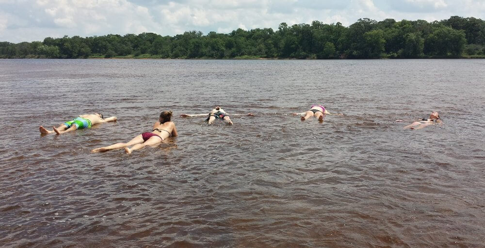
Quintessential Canoe Camping Conditions

It only took half the season but we're finally into the idyllic summer canoe camping conditions. Water levels have returned to seasonal norms so sandbars are out in force. Water temps are like bath water but still cool enough to escape the 90+ heat. Forecast is typical mid-summer with heat, humidity, and chance of a storm rolling through. It's everything you imagine it is right now.

We're currently sold out and aside from a few updates here and there, will likely stay that way. If you see something come available, grab it - it's not gonna be there long.

Already made reservations and getting ready for you trip? Here's what I'd recommend above and beyond the usual for this week:

  • Shade! Sun hat, umbrella, sun shade, tarp tied between sticks? Bring it all. The sun is intense and the canoes/sandbars will be cooking during the daytime hours. If you don't have it, Walmart sells some basic 10'x10' sun shades for under $100. Bonus if they have a screen for sunset mosquitoes. Lots of sun screen goes without saying.
  • Drinking Water - grab a couple gallon size jugs now and make room in your freezer. You'll thank me after a full day in the sun and your friends are all drinking boiling water. Bonus points for adding dry ice to your cooler for extra cold, and if you put your grapes/oranges near it, they'll carbonate (Hyvee sells dry ice in convenient blocks).
  • Storms - it's always possible to have some big storms come out of nowhere when there's so much moisture and energy in the atmosphere. They are a fact of life in the wilderness (which this technically is) so be prepared for one.
    1. Read up on how to be safe on the river and be careful of your tents. The biggest risk in a storm isn't the lightning but the wind. The big gusts that come right before the rain can shred a tent and snap poles if it isn't properly set up.
    2. Use those guylines (long lines attached to the tabs half way up the side of your tent), or even drop the poles temporarily while the wind is up even if it means getting a little wet. This is more important for weaker fiberglass poles than metal ones. The bonus here is that your tent won't up and fly away like mine may or may not have done 10 years ago on a guided trip...
    3. Only have tiny tent stakes and a lot of sand? Don't panic. I've had very good luck scraping away the top layer of loose sand and driving the stake into the firm wet stuff below at a significant angle away from the tent. Cover it back over with the loose sand and repeat 4 -10 times. Want to go full hurricane mode? Tie your guylines around sticks, paddles, rocks, even a canoe, and bury them to create deadman anchors. Throw the water jug in the tent for good measure.
  • Alcohol and life jackets - Last thing I'll mention, given how hot it is and the amount of time you're likely to spend in the water with a drink in your hand: wear your life jacket! While rare, people do drown out here. If you can muster the last of your good decision making brain cells to put on the life jacket before lounging in the water off a sandbar 7 margaritas deep, you might thank me.

With all of that out of the way, have a great trip this week! -Ryan

Shallow sandbars on the Wisconsin River

Finally! Great Conditions

I rate this coming July 12-14 weekend a solid 7.5 out of 10. Sandbars are popping out left and right today and water levels will continue their big drop for the next few days at least. They could be a little lower (thus the 2.5 point deduction) given this will be one of the three busiest weekends on the river but you shouldn't have to be camping on top of people.

Everything else is great! Water temps are in the high 70s. Air temps will be in the high 80s but not nearly as humid as it's been. Sleeping in tents will be pretty pleasant with drier air in the upper 60s. Winds will be calm and low chance of storms. And since this is only about the third time sandbars have been above water this spring, all of the beaches should be very clean and well washed.

Get after it! -Ryan

A few more days and we’ll be there

[Quick update: 7/8 1:47pm - Flow rates up north have dropped by half (18kcfs to 9kcfs) so by Wednesday afternoon we'll be in the clear with sandbars coming on strong shortly after]

The weather forecast looks amazing (finally!). The next 10 days are mostly sunny with highs in the mid 80s. Water levels are still high but will be dropping quickly on our section. Sandbars should be back out as soon as Wednesday with more appearing daily after that. The bulk of the past two weeks of rain is through the system and lower levels in the northern half of the state plus full summer vegetation and the clear forecast all make for a very quick turnaround.

Not expecting any issues for this coming weekend - which is great because we're 98.9% sold out.

Wait just a dam minute

Update: 1:12pm 7/5/19

Water is back up (about 6" too high), overnight trips are cancelled but day trips are still on. Should be good to go for overnight trips by early next week. This time of year, water will drop quickly to low levels and lots of sandbars.

Update: 10:56am 7/2/19

Well this just got interesting, albeit the timing could have been better before we sent all those cancellation announcements. All of a sudden, flow rates at arguably the most important dam on the river have been cut dramatically despite the most recent river predictions. If this new flow rate holds, trips should be good to go by Friday (still small and limited sandbars though). Graph below - 12kcfs is okay, less than 10 is great. The water at this gauge takes ~36-48 hours to reach us.

===================================

Update: 10:16pm 7/2/19

It happened. Lots of rain dropped right on top of the watershed over the past two days at the worst possible place. Overnight trips are cancelled through at least Sunday. There's still quite a bit of shakey weather to come so it's entirely possible this gets pushed out longer before sandbars come back in reasonable numbers (graph below will continue to update daily).

We're still putting out day trips but you're looking at a small handful of wet sandbars to stop at so the option to cancel an existing reservation will be there. On the other hand, lots of access to backwater routes you otherwise couldn't get into very well with the extra foot of water depth. Worth keeping in mind that currents will be a little faster and with fewer places to stop so I wouldn't recommend this as a first time trip.

More updates to come as this very hot, humid, and unstable week unfolds.

-Ryan

==============

Central and southern Wisconsin have been getting hit pretty good these past two days. Enough so that we're now flirting with water levels above our sandbars again. For the next two days we'll be right at our self imposed limit for overnight camping. Day trips shouldn't be a problem as everything currently sits. Overnight trips should be fine for Tuesday and Wednesday but it's questionable for Thursday-Sunday.

We're a little limited on foresight with this one because most of the rain has fallen very close to our location. The increase doesn't show up on river forecasts until it's already on top of us so it becomes more educated guessing. My guess is that the disconnect between Castle Rock and every dam above it (10kcfs differential when 3-4kcfs is normal) means river managers are trying to stay ahead of our moist forecast. I don't think the rain we've already had quite justifies what we're seeing (but I could be wrong). Long story short, if this is the case and our forecast holds steady or improves, I think this weekend will be doable (albeit with small sandbars). If we end up getting a few storm trains, we're probably underwater.

The graph below is going to be your best bet to know what's coming in the PDS-Spring Green area. It doesn't account for the Baraboo River tributary but it's been holding around 1kcfs for the past few weeks, i.e. mostly inconsequential. Further downstream of us you've got a few big tributaries like Otter Creek in Lone Rock, the Pine River in Gotham, and the Kickapoo River in Wauzeka plus lots of smaller creeks that were hit hard yesterday and will likely make anything downstream of Muscoda not campable regardless of what happens this coming week.

We're aiming to be near or below 13.5' to send out overnight trips. I don't like 14' but it is doable for groups that are dead set on camping out. Again, day trips should be fine unless something crazy happens.